


After a much sunnier visit to the Sounds, our next stop was Dunedin. Unfortunately, my cold was at its apogee, so I stayed in the cabin trying to get better while the rest of the passengers went to sample the charms of the town I missed the last time around due to the less-than-scenic railway expedition.
I was looking forward to the next stop, Lyttelton, which was really a gateway (the closest port) to Christchurch. I was even feeling better, hoping for an opportunity to visit the third most populous city in New Zealand. Alas, just a few minutes before we were due to enter the harbor, the captain came on the public address system to explain that the local pilot, who steers the ship to its berth, decided that it was too windy to let the big ship enter the small port. Another sea day for us, an extra day for me to get totally well.
Which I did by the time we reached the second-most populous city in New Zealand, its capital, Wellington. New Zealand moved its capital from Auckland, the largest city, to Wellington, because of geography and demographics. Auckland sits at the top of the North Island, and being the largest city to boot, the citizens of the South Island felt that the focus of government was, perhaps inadvertently but inevitably, centered on the needs of the North Islanders. So the capital was moved to the bottom of the North Island, just a ferry ride from the South Island.
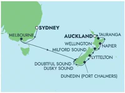
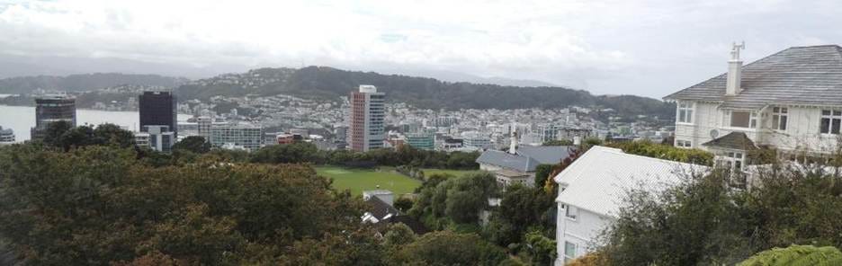
I could glimpse Wellington as we were entering the harbor:
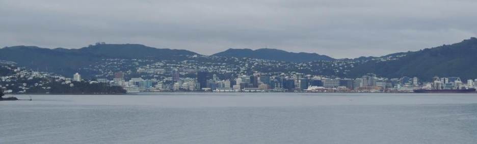
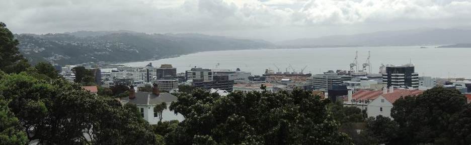
As we moved closer to port, many office and government buildings came into view:
There were many excursions available through the cruise line, but I wanted to explore the city itself. Plus, this being Sunday, I wanted to get to church.
I took a free shuttle into the city center, where we were met by the helpful iSITE agents handing out city maps and other information. I confirmed this was the spot where the shuttle would pick us up to take us back to the ship (this point is important to the end of the story), and set off for the church.
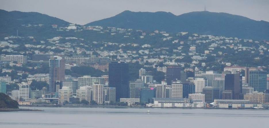
I passed through the downtown area, deserted at this hour on a Sunday:
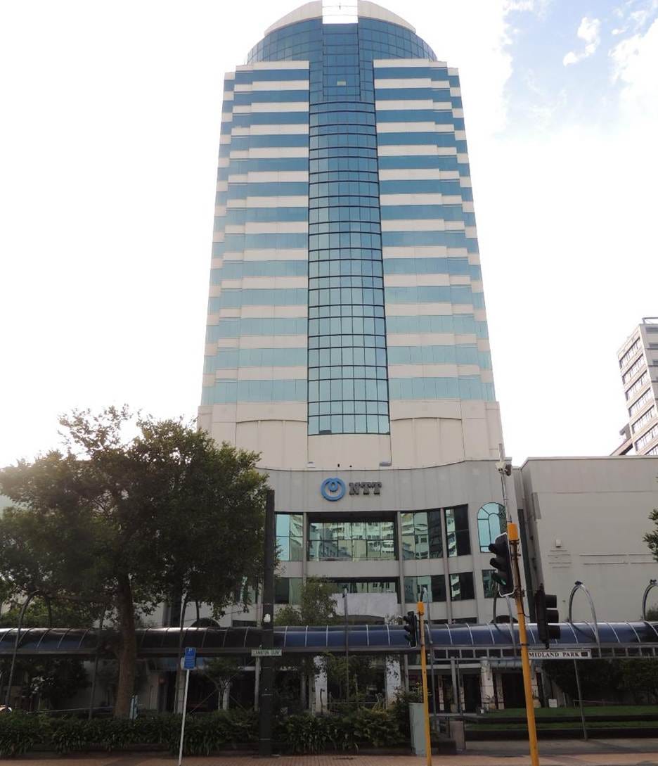
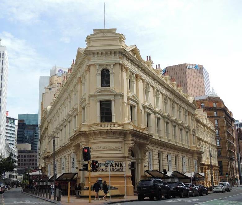
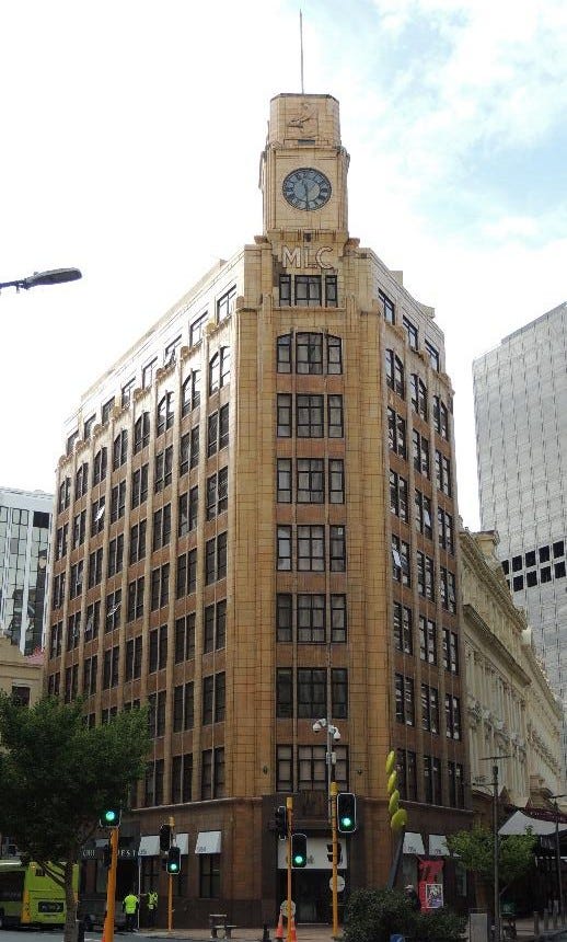
Along the way, I spied a building belonging to my former company:
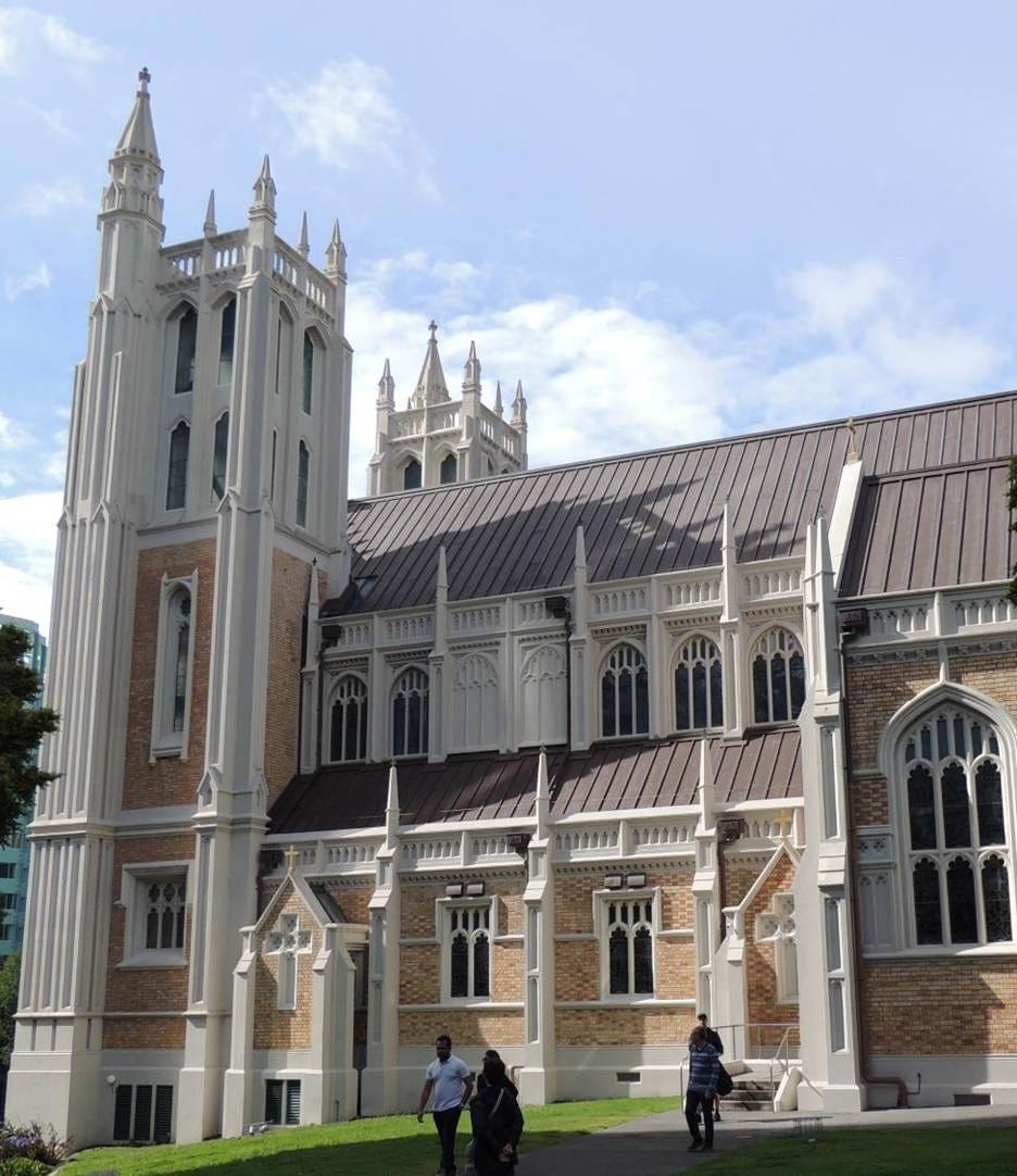
The church turned out to be quite beautiful:
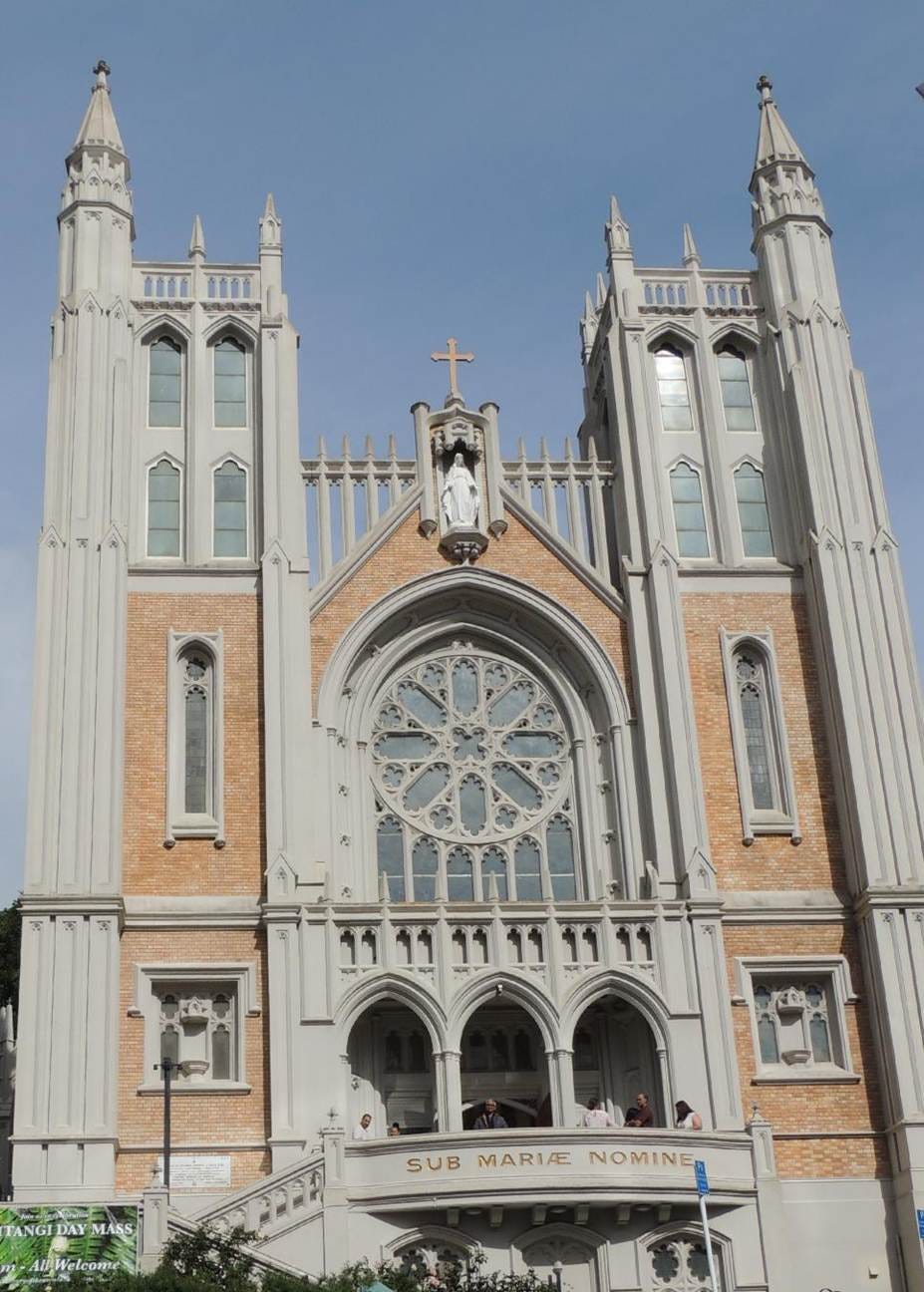
, both outside:
, and inside:
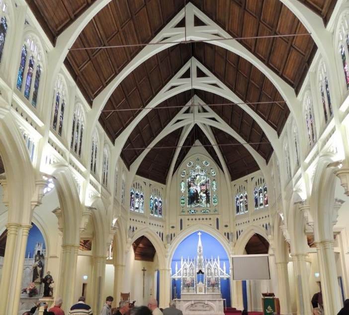
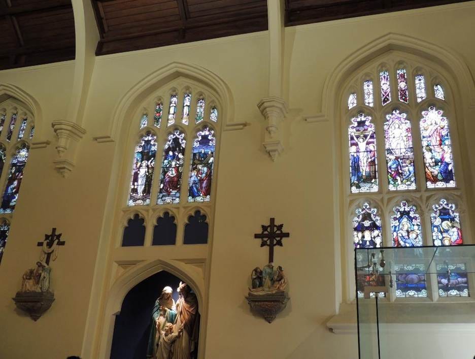
, with a nice organ and a competent organist:
Next on my agenda was the famous Wellington cable car. Here it is arriving at the bottom of the line:
There were a couple of opportunities to snap a view of the city on the way up, but they came and went pretty quickly:
The whole ride was just a few minutes! There were better photo opportunities on top, on platforms around the Cable Top café.
You can just make out the ship’s smokestack and a couple of top decks, on the left:
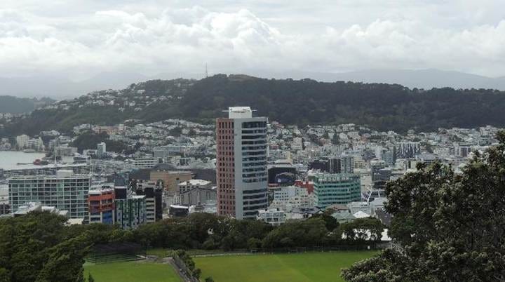
The bulk of the city:
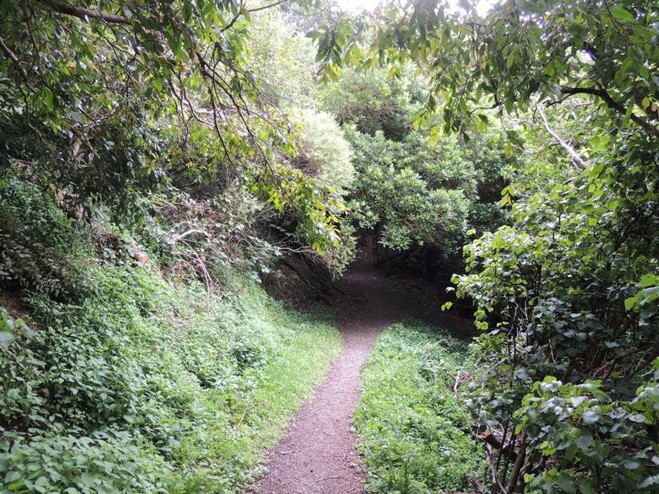
It seemed… wimpy to take the cable car back down, so I decided to hike down this trail:
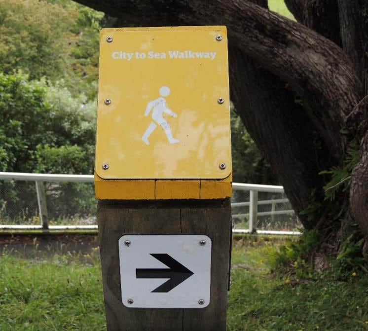
The “walkway” was apparently seldom trodden. Its stair steps were covered with leaves, and portions of it were simply dirt paths:
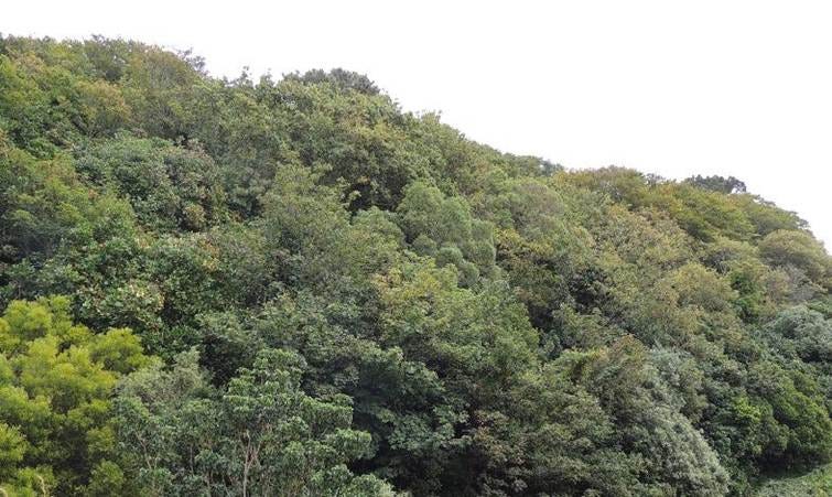
It left Google Maps thoroughly confused! It thought I was descending down the hill walls. In a way, I was; here’s where I emerged from:
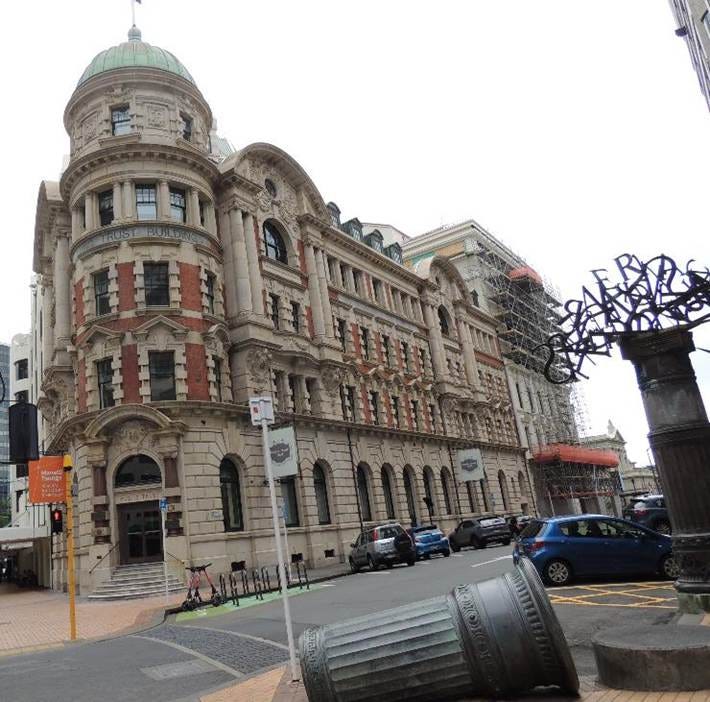
But soon enough, I was back in town. I saw many buildings that were built on sharp corners, sort of like the Flatiron building in NYC:
Note the unusual… sculpture? … in the foreground:
Here’s another interesting sculptural group:
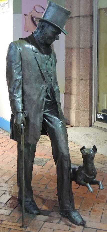
This is the most popular statue in Wellington! It depicts John Plimmer, an English settler and entrepreneur known as the “Father of Wellington,” with his dog Fritz. It was created from an actual photograph taken around 1900.
At this point, it started drizzling, despite the forecast predicting nothing of the sort until much later in the day. I was unprepared, and decided to hightail it back to the ship. Except… I had no idea where the shuttle was! Oh, I ascertained it would pick us up at the same spot it delivered us to, but I forgot to note where the spot was! All I could remember was a strange circular building nearby that reminded me of the Tower of Babel paintings.
I tried to reconstruct my original walk to the church, but the streets did not look that familiar. Google Maps to the rescue! I was able to look up my Timeline and figure out the direction of travel. Soon enough, I saw the strange building:
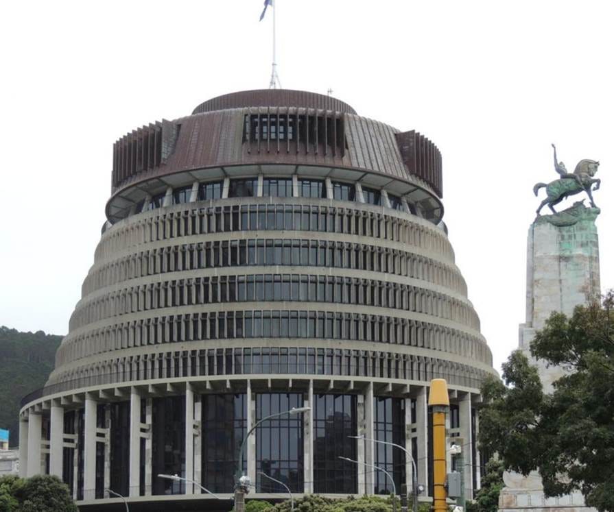
Later, I found out that it’s called “The Beehive,” and serves as the Executive Wing of the New Zealand Parliament. In commemoration of it serving as my beacon, I bought a magnet with its image on top.
Incidentally, the statue you see on the right is the Wellington Cenotaph, a national memorial dedicated to New Zealand soldiers who served and died in World War I and World War II. If you remember, such commemorative statues and gardens are in every town and city I have visited in both New Zealand and Australia so far. These allies contributed more than their share to our common struggles!
Next: an all-day excursion guided by a fellow passenger local to the area!
Nice pictures. I was there in 1973. Its changed a lot. I remember a Sunday in Christchurch when all the church bells in the city pealled for ages. It was the wedding of Princess Anne and Mark Phillips. Royalists to the core. I think many of those churches came down in the earthquake. Wonderful country.
Love the Google Timeline rescue moment. That feature is so underrated for travel navigation when nothing else looks familiar. The Beehive serving as yur landmark is a perfect example of how architecture becomes wayfinding in unfamiliar cities. Wellington sounds beautifully walkable despite the unexpected trail conditions, probly more rewarding than another generic shore excursion.